
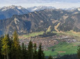
Bike and Hike Tour to the Kreuzspitze, the highest mountain in the Bavarian part of the Ammergau Alps. First you cycle the flat part of the tour to the foot of the mountain and continue the steeper path on foot.
Good to know
Directions
The tour starts at the parking lot behind Graswang in the direction of Linderhof.
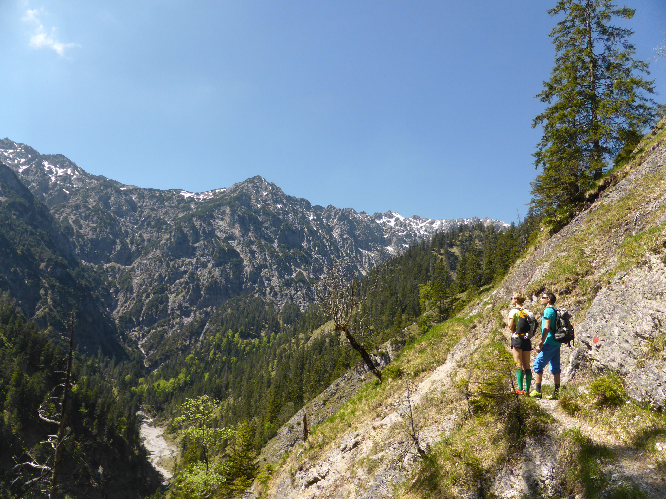
You can also cycle here from the surrounding villages. From the parking lot you cycle south for approx. 3,5 km, slightly uphill on a forest road Valley of the Elmaugris (This route can also be hiked on foot). Shortly before the path turns slightly downhill to the right into the Kuchelbachtal, the climb begins (note: the junction is not signposted).
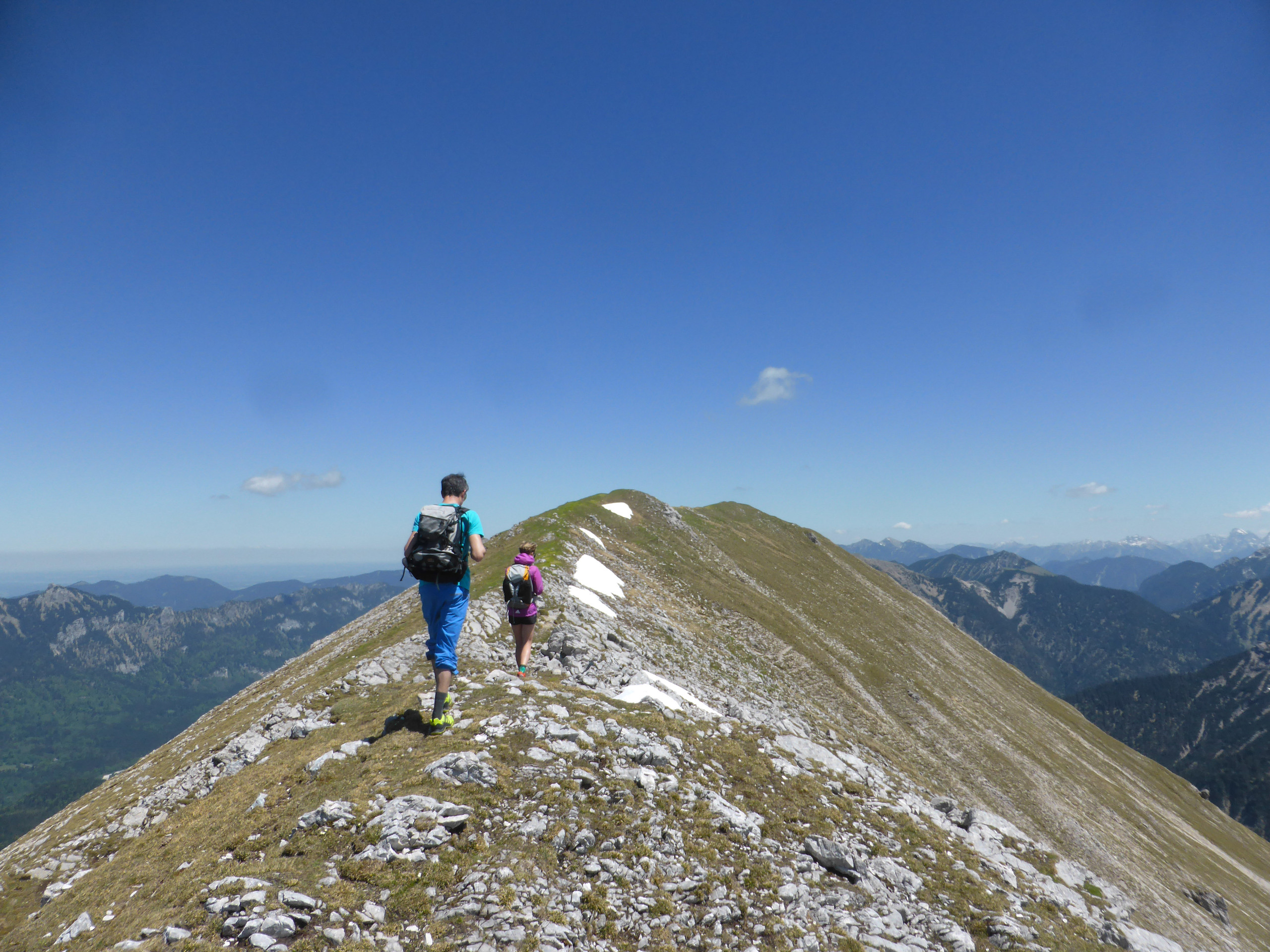
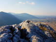
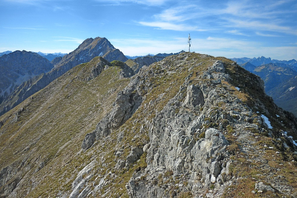
Leave the wheels here and get in pleasant serpentines on a path to Kuchelberg. Passing the Kuchelberg service hut (1.597 m) you reach the Kuchelberggrat after about 7 km - the Highlight of the tour. Follow the promising one Climb to the Kuchelbergspitz. You should take a break here at the latest to enjoy the impressive view.
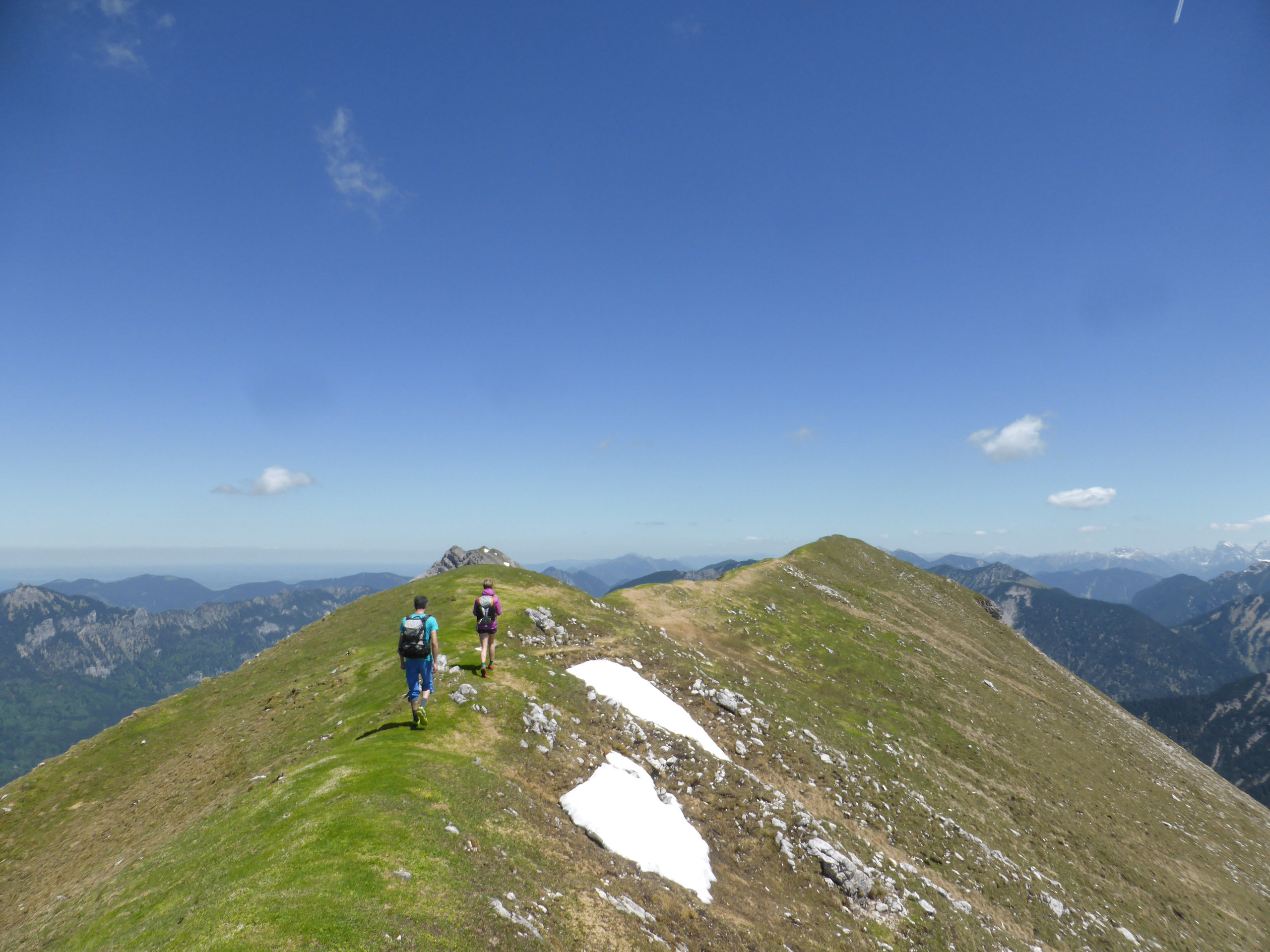
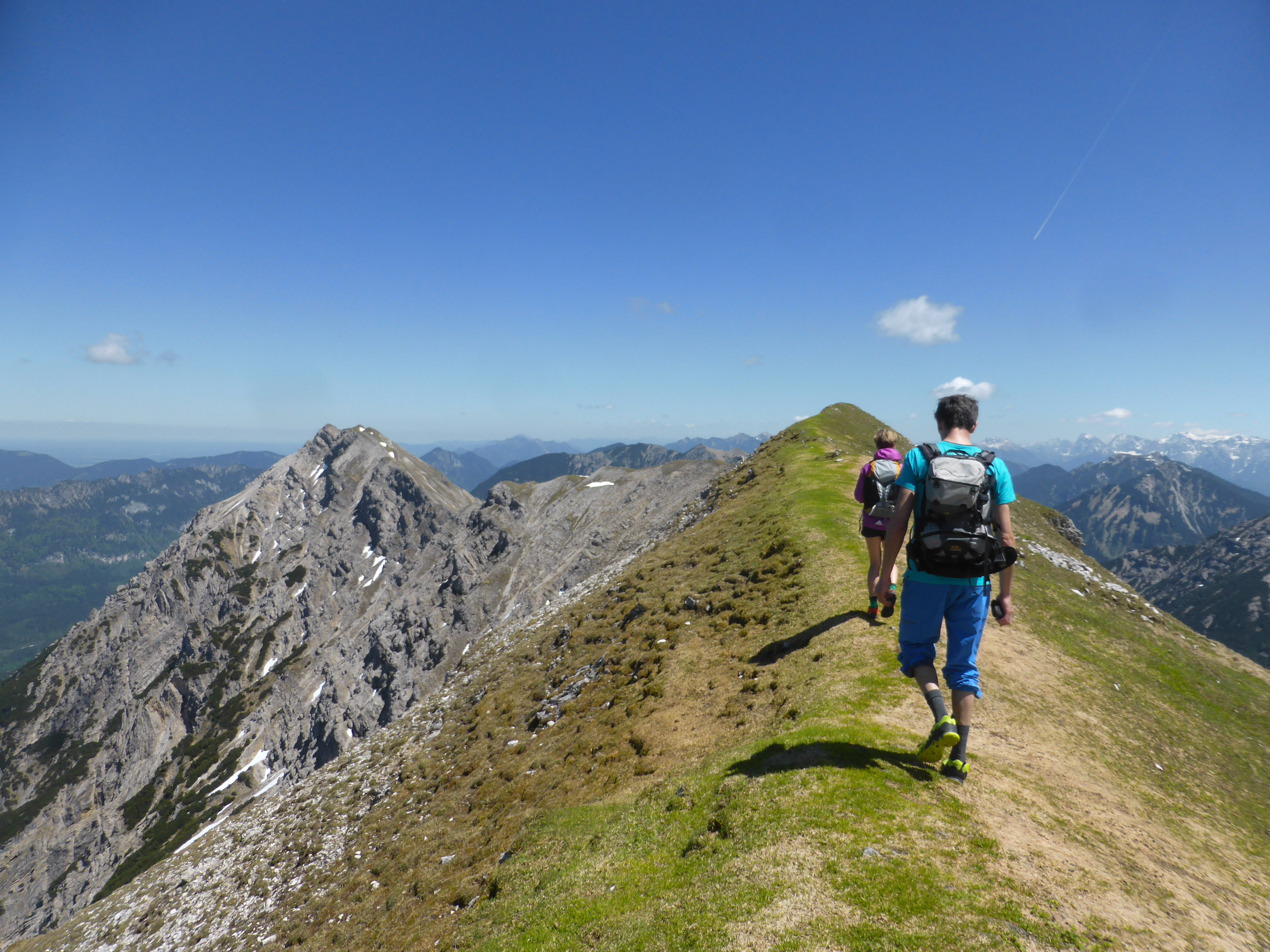
From here the path follows highest peak in the Bavarian Ammergau Alps, the Kreuzspitze (2.185 m). As with the entire route over the Grat The view extends from the Wetterstein Mountains over the Lechtal Alps to the foothills of the Alps.
About halfway between Kuchelbergspitz and Kreuzspitze a path meets your path from the bottom left. You will return this way later Kuchelbachtal. After climbing the Kreuzspitze, go back the same way a little before turning right downhill into the valley. Walk along the Kuchelbach to the bicycles and from there on the familiar path back to Graswang.
Our recommendation:
Never get lost again - We recommend the free “Zugspitz Region” app with, among other things, GPX tracks for all tours in the region
safety instructions
Im Emergency Please contact the nearest rescue control center. Regardless of your location, you can reach them throughout Germany at Phone number 112.
Facilities
Welcome to Teststubn Nature Park! With us you can extensively test hiking poles, daypacks, children's carriers and groceries from well-known manufacturers before you decide to buy. Let our team advise you on how to experience the best outdoor adventure possible. Our Teststubn Nature Park can be found in the tourist information Bad Bayersoien and Bad kohlgrub and in the Bike rental Lukas Spindler in Oberammergau.
Mehr Informationen: www.ammergauer-alpen.de/teststubn
Author's tip
Especially in autumn, the view from the Kuchelberggrat of the colorful forests is a beautiful natural spectacle.
Arrival & Parking
Fürstenweg car park, Graswang
There is no charge for parking
Parking time: no time limit
Public transportation
Map
Maps are available from the local tourist information offices.
More information / links
author
Natural Park Ranger
Organization
